

By MAURIPRO Rigging Specialists · Updated March 2026
Marine cartography represents the cornerstone of safe navigation, providing mariners with precise bathymetric data, coastal features, and hazard identification essential for confident passage planning. Modern electronic chart systems have revolutionized how experienced sailors access and interpret nautical information, offering real-time updates, enhanced detail layers, and seamless integration with onboard electronics.
At MAURIPRO, our comprehensive marine cartography selection features industry-leading solutions from Garmin, Navionics, C-MAP, and Humminbird. From Garmin's BlueChart g2 Vision HD series covering critical coastal regions to Navionics Platinum+ charts spanning international waters, our catalog serves demanding navigators who require accurate, up-to-date cartographic data. Whether you're cruising familiar home waters or exploring distant coastlines, professional-grade electronic charts provide the detailed coverage and reliability that serious mariners depend on for safe passage.
How to Choose the Right Marine Cartography
Coverage Area and Regional Specifications
The most critical factor in selecting marine cartography is ensuring comprehensive coverage for your intended navigation areas. Garmin BlueChart g2 Vision HD offers extensive regional coverage with options like VUS511L for Boston to Norfolk, VUS512L for Mid-Atlantic waters, and VUS513L covering Jacksonville to the Bahamas. Each chart provides detailed bathymetric data, harbor information, and coastal features specific to these regions. For West Coast navigation, the VCA501L Vancouver Island chart delivers precise Canadian Pacific coastline data with tidal information and local hazard markers.
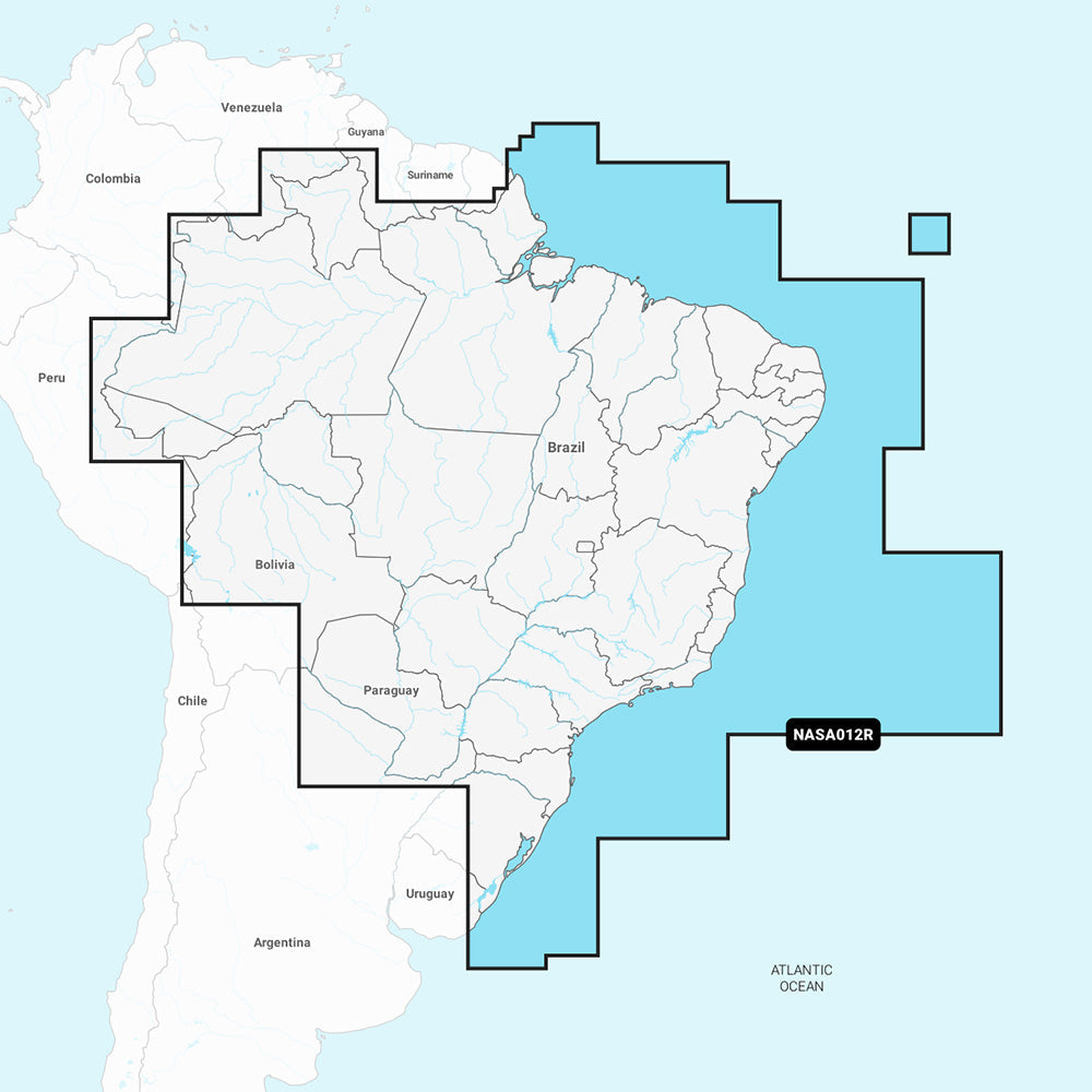
International and extended coverage requirements demand specialized chart solutions. Garmin Navionics Vision+ charts like NVSA004L cover Mexico and the Caribbean to Brazil, while NVSA005L extends to Chile, Argentina, and Easter Island. These charts include critical offshore waypoints, international port facilities, and regulatory boundary information. The Humminbird CoastMaster Premium Edition for Florida provides state-specific detail including detailed inland waterway coverage, bridge clearances, and local fishing hotspots that generic charts often omit.
Chart Detail Level and Bathymetric Precision
High-definition cartography systems provide varying levels of detail depending on the technology platform. Garmin's g2 Vision HD series incorporates 1-foot contour intervals in many areas, satellite imagery overlays, and detailed port plans with approach vectors. The VUS515L Brownsville to Key West chart includes extensive shallow water detail crucial for Gulf Coast navigation, with color-coded depth ranges and bottom composition indicators. These charts also feature Auto Guidance technology that calculates optimal routes based on your vessel's draft and beam specifications.
C-MAP 4D technology offers dynamic chart updating and community-sourced bathymetric data through Genesis Live mapping. The NA-063 Chesapeake Bay to Cuba chart provides real-time depth information and user-contributed hazard reports. The NA-D021 Canada North and East chart includes ice coverage predictions and seasonal navigation warnings. Navionics Platinum+ charts deliver similar precision with SonarChart Live integration, allowing real-time depth contour updates and bottom hardness information critical for anchoring decisions.
Compatibility and System Integration
Marine chartplotter compatibility determines which cartography formats your navigation system can utilize. Garmin chart cards require Garmin-compatible plotters but offer seamless integration with Garmin autopilot systems, radar overlay capabilities, and NMEA 2000 sensor data fusion. The microSD format ensures compatibility across Garmin's marine electronics lineup, from handheld units to integrated bridge systems. BlueChart g2 Vision HD cards automatically configure display settings and provide optimized zoom levels based on your specific plotter model.
Universal compatibility solutions like C-MAP 4D charts work across multiple manufacturer platforms including Garmin, Raymarine, and Simrad systems. The microSD/SD dual format cards adapt to various slot configurations without requiring format conversion. Navionics charts provide broad compatibility through their Navionics Boating app integration, allowing chart viewing on tablets and smartphones as backup navigation tools. Chart updates and downloads synchronize across all connected devices through cloud-based chart management systems.
Advanced Features and Navigation Aids
Satellite imagery integration distinguishes premium cartography from basic chart packages. Garmin BlueChart g2 Vision HD cards include high-resolution aerial photography of harbors, marinas, and coastal landmarks for visual navigation reference. The VUS517L Alaska South chart incorporates satellite imagery essential for remote area navigation where traditional landmarks may be unreliable. These visual references prove invaluable during poor visibility conditions or when approaching unfamiliar ports.
Dynamic data integration enhances navigation safety through real-time information overlays. C-MAP 4D charts display current weather routing, tide predictions, and marina services information directly on the chart display. Navionics Platinum+ charts include community editing features where users contribute local knowledge about hazards, anchorages, and navigational updates. The Garmin GC14 Marine Camera integrates with chart systems to provide live video feeds of critical navigation areas, enhancing situational awareness in congested waterways or challenging docking situations.
Brand Overview
| Brand | Models in Stock | Price Range |
|---|---|---|
| Humminbird | 1 models | $600 |
| Garmin | 9 models | $400–$450 |
| Navionics | 2 models | $400 |
| C-MAP | 2 models | $353 |
Technical Decision Matrix
Compare key specifications across brands and models to find the right fit for your boat and sailing style.
Frequently Asked Questions
What's the difference between Garmin BlueChart g2 Vision HD and Navionics charts for coastal navigation?
Garmin BlueChart g2 Vision HD charts include detailed bathymetric data, aerial photography, and 3D perspective views of ports and harbors, making them excellent for visual navigation in unfamiliar waters. Navionics charts focus on highly accurate depth contours, fishing hotspots, and community-sourced updates through their Fresh Data service. Both offer similar coverage areas, but Garmin's Vision HD series provides more visual context while Navionics excels in fishing-specific features and crowd-sourced accuracy updates. MAURIPRO carries both brands with regional coverage options starting at $400-450 depending on your cruising area.
Do I need different chart formats for different GPS manufacturers, or are they interchangeable?
Marine charts are typically manufacturer-specific and not directly interchangeable between different GPS brands. Garmin plotters require Garmin BlueChart formats, while other manufacturers have their own proprietary systems. However, C-MAP charts work across multiple plotter brands including Garmin, Raymarine, and Simrad through their universal microSD format. MAURIPRO stocks region-specific charts from Garmin, Navionics, Humminbird, and C-MAP to ensure compatibility with your existing electronics package.
How often should I update my marine charts, and what's the difference between basic and premium chart versions?
Marine charts should be updated annually or bi-annually depending on your cruising area, as channels shift, new hazards appear, and aids to navigation change. Premium versions like Garmin's BlueChart g2 Vision HD include aerial photos, 3D harbor views, and Auto Guidance routing, while basic versions provide essential depth and navigation data only. Navionics Platinum+ and Vision+ series offer community-sourced updates and enhanced fishing features beyond standard charts. MAURIPRO recommends premium charts for frequent cruisers and basic versions for occasional coastal navigation.
What chart coverage do I need for sailing from Florida to the Caribbean?
For Florida to Caribbean cruising, you'll need charts covering the southeastern US coast, Bahamas, and eastern Caribbean islands. The Garmin BlueChart g2 Vision HD VUS513L covers Jacksonville to the Bahamas, while the VUS515L handles Brownsville to Key West for comprehensive Florida coverage. For extended Caribbean cruising, add the Garmin Navionics Vision+ NVSA004L which covers Mexico and the entire Caribbean to Brazil. MAURIPRO stocks all these regional charts with overlapping coverage to ensure seamless navigation throughout your cruise.
Are microSD marine charts as reliable as traditional paper charts for offshore passages?
Modern electronic charts from reputable manufacturers are actually more current and detailed than paper charts, as they receive regular updates and corrections that paper charts cannot match. However, experienced offshore sailors maintain paper charts as backup since electronic systems can fail due to power loss or equipment malfunction. Electronic charts also provide dynamic features like GPS overlay, route planning, and real-time position tracking that paper cannot offer. MAURIPRO recommends carrying both electronic charts and essential paper charts for offshore passages, with your primary navigation relying on regularly updated electronic systems.
Shipping & Support
MAURIPRO offers free US shipping on orders over $99, a price-match guarantee on all marine cartography, and dedicated rigging experts available by phone or email. Contact our rigging team for personalized product recommendations.
Explore Complementary Products
Browse related categories to complete your setup:
Marine Electronics · Instrument Pods · Engine Meters · Ask our Electronics Team